
MAP LOFOTEN ISLANDS V1
Original price was: 29.99€.24.99€Current price is: 24.99€.


68.98€ Original price was: 68.98€.39.99€Current price is: 39.99€.
→ MAP + GUIDE (eBook) + DIGITAL ATLAS
This luxury Pack for a travel to the Faroe Islands includes 3 essential products:
1 – Map of the Faroe Islands printed on thick waterproof paper (postal delivery)
2 – Guide to the Faroe Islands (ebook, 189 pages)
3 – High Definition Digital Atlas which contains the main map as well as other detailed maps (ebook, 64 pages)
→ The 2 ebooks are available for instant download after purchase.
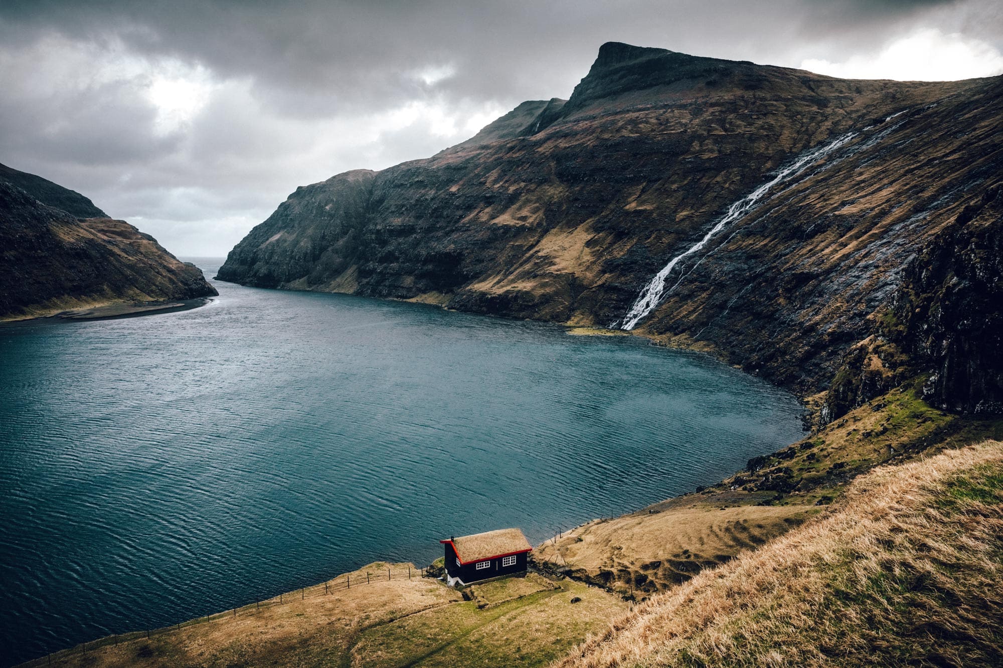
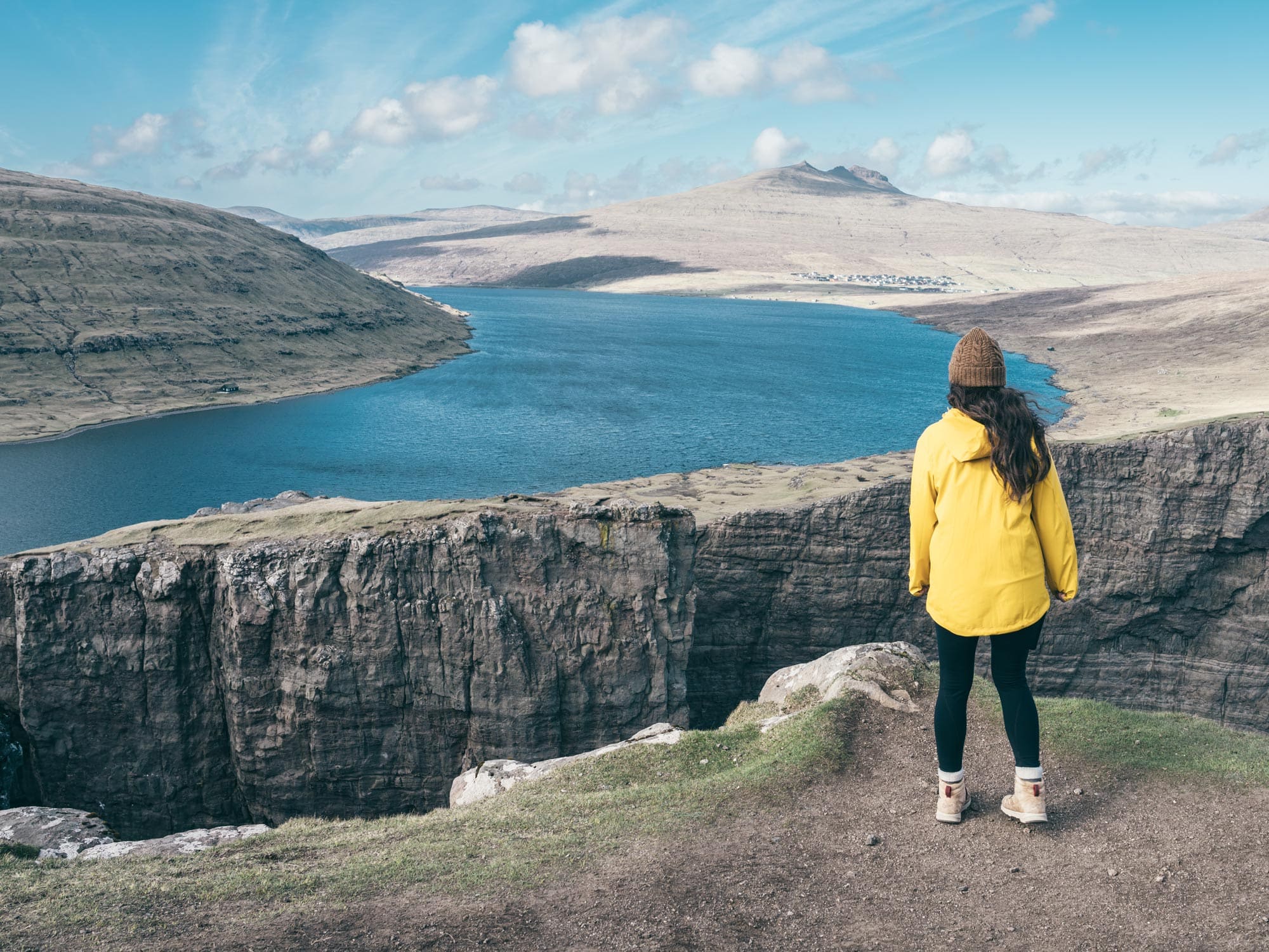
The Faroe Islands are a photographer’s paradise.
The Travel Pack brings together all the resources you need to optimize your trip to the Faroe Islands.
Three essential tools to not miss anything of this flamboyant territory with unforgettable panoramas.
This project received support from Visit Faroe Islands.
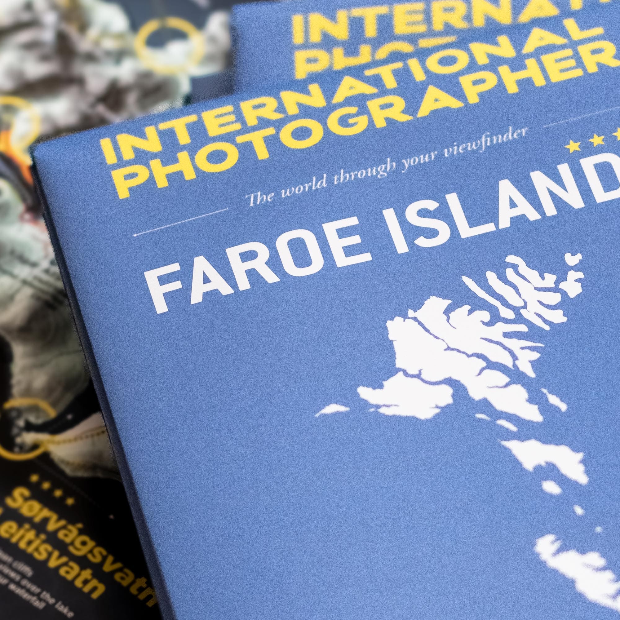
The Faroe Islands are the real favorite of INTERNATIONAL PHOTOGRAPHER. This country has offered us the most beautiful lights and incredible points of view. Photographers and hikers in love with Iceland and the Nordic countries cannot remain indifferent to the landscapes of the Faroe Islands.
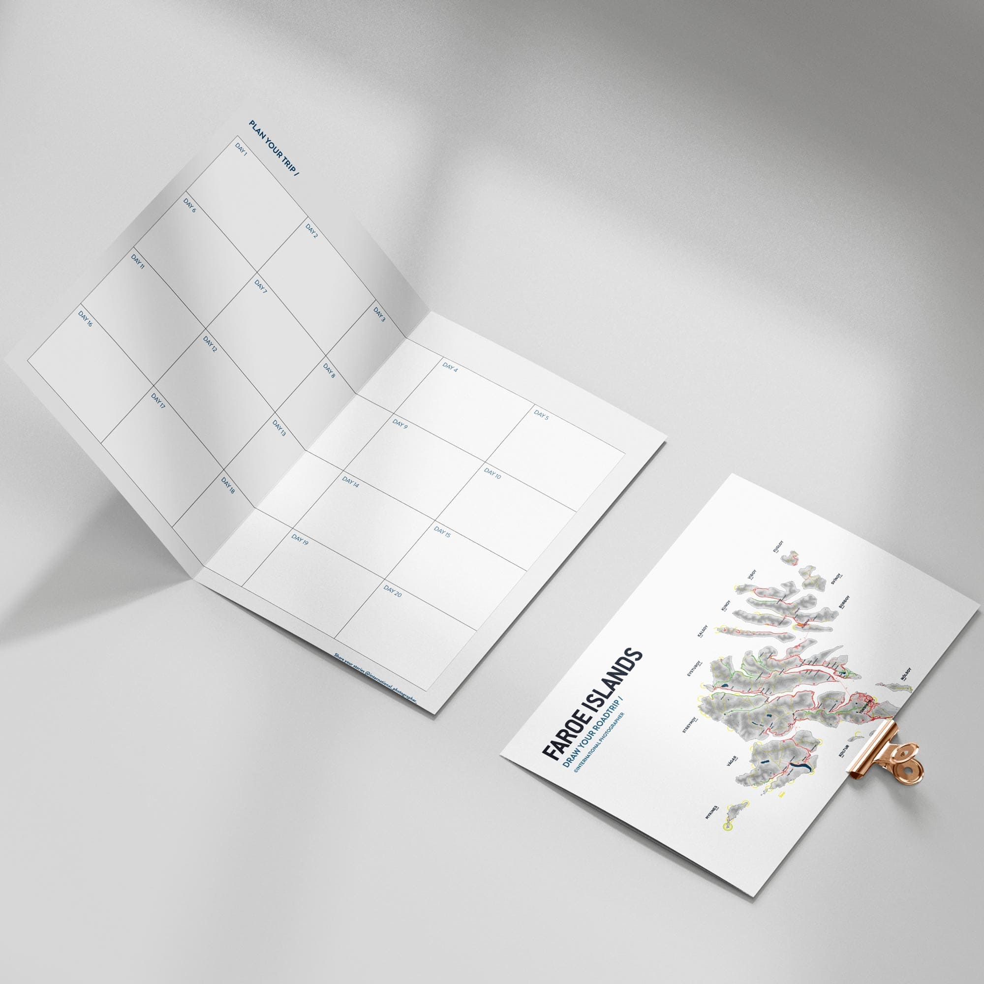
Our map and guide to the Faroe Islands guide you through this vast archipelago of 18 islands.
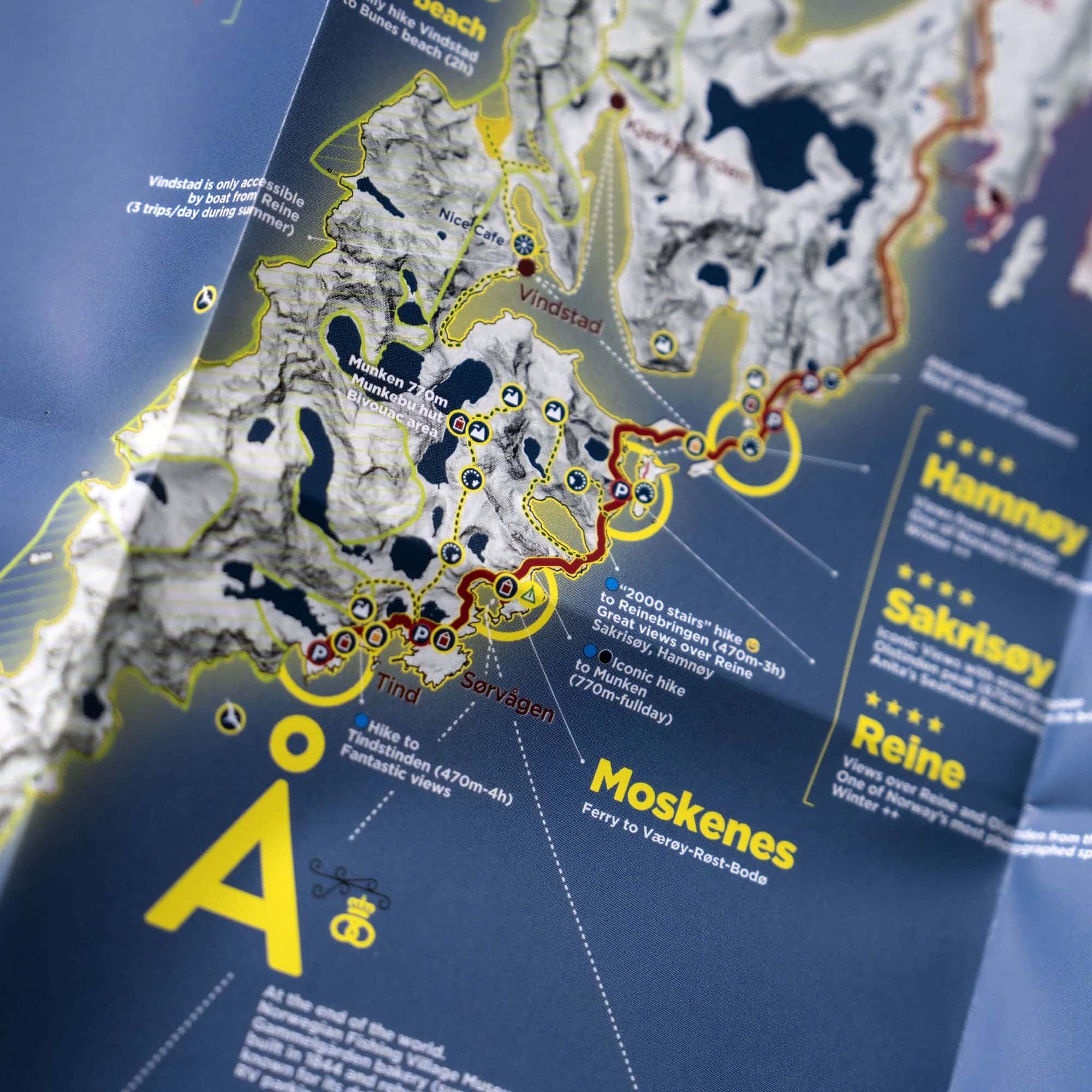
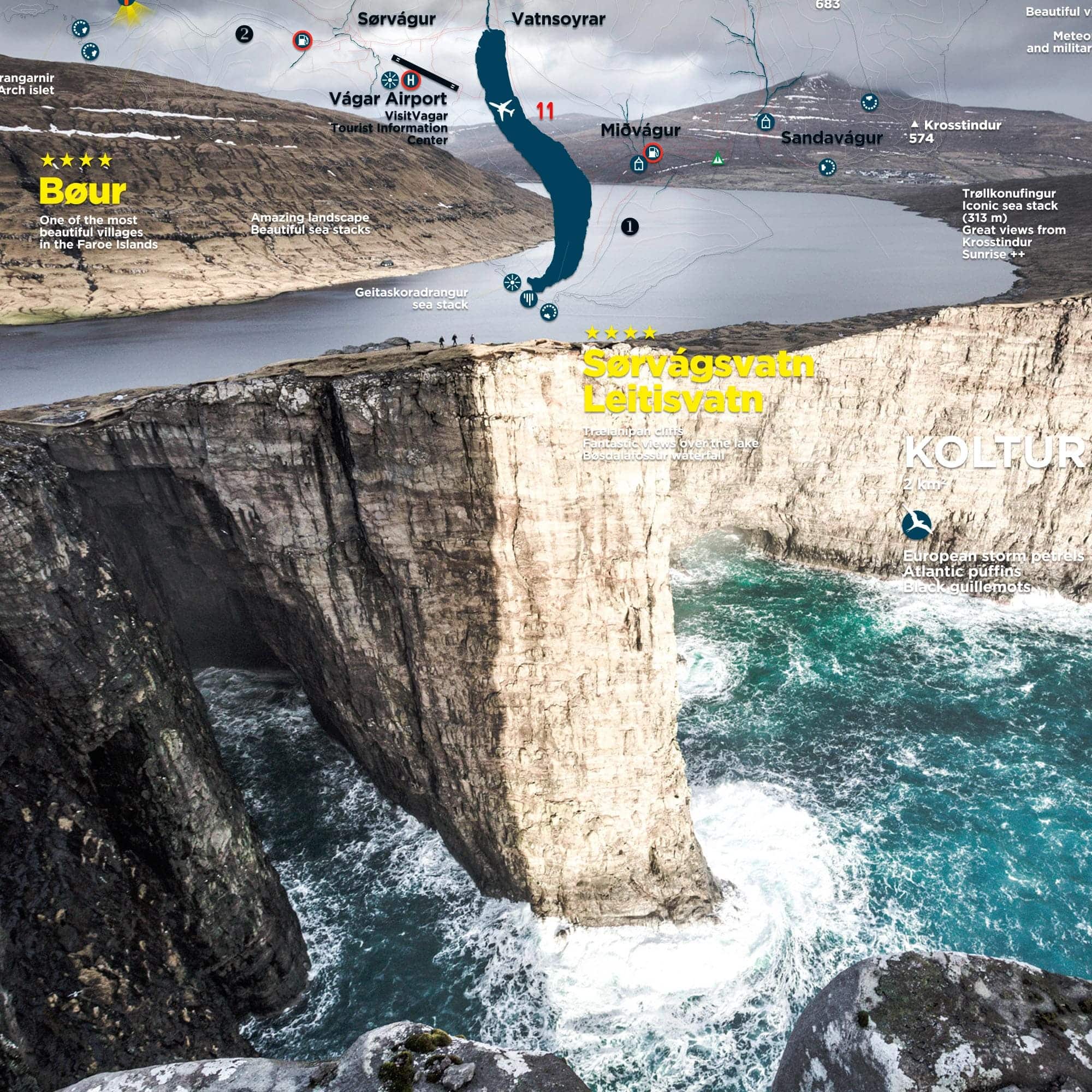
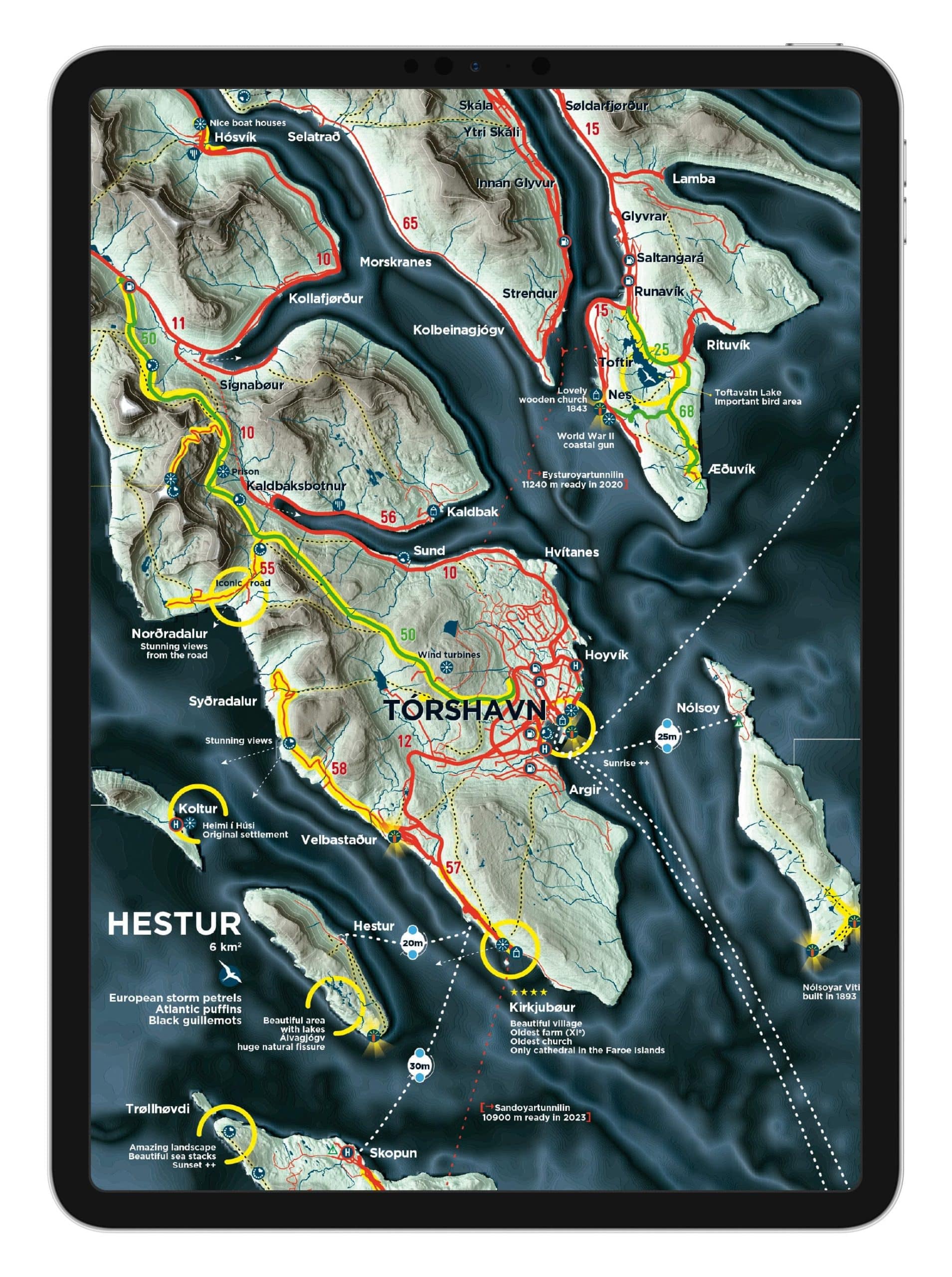
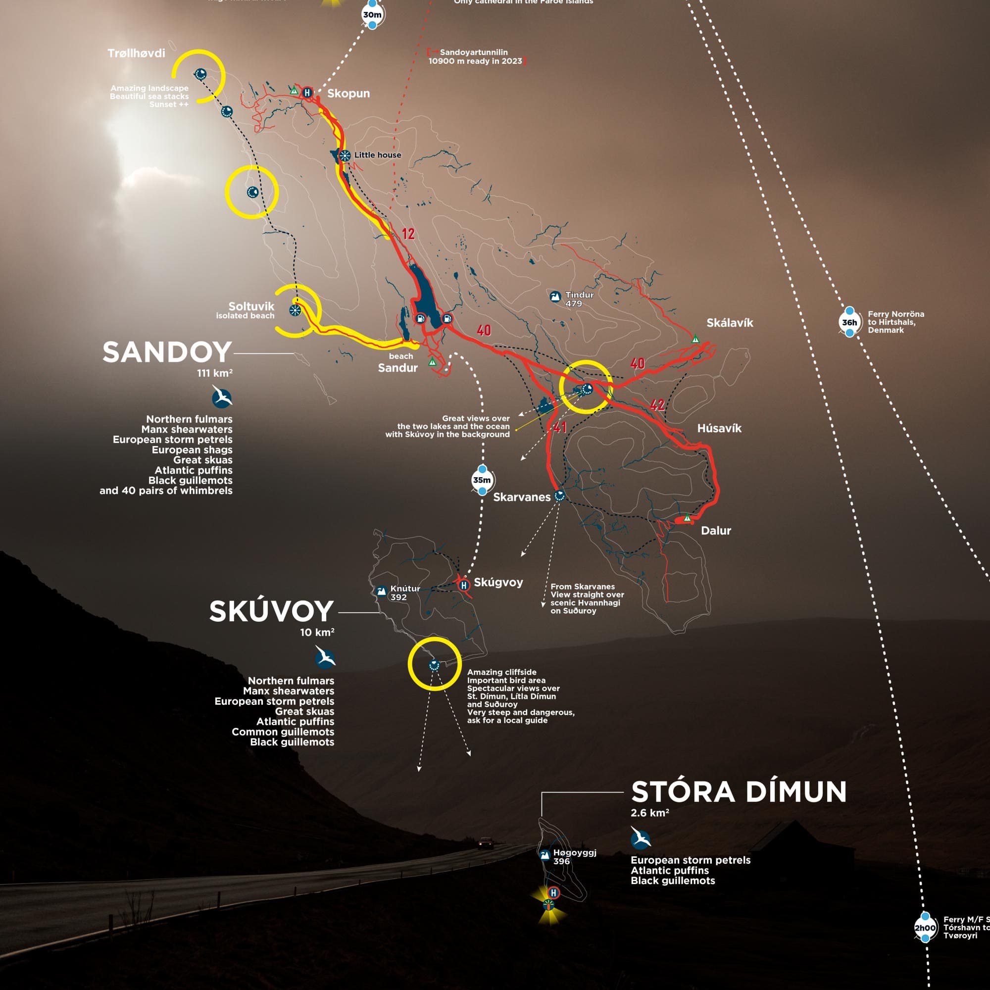
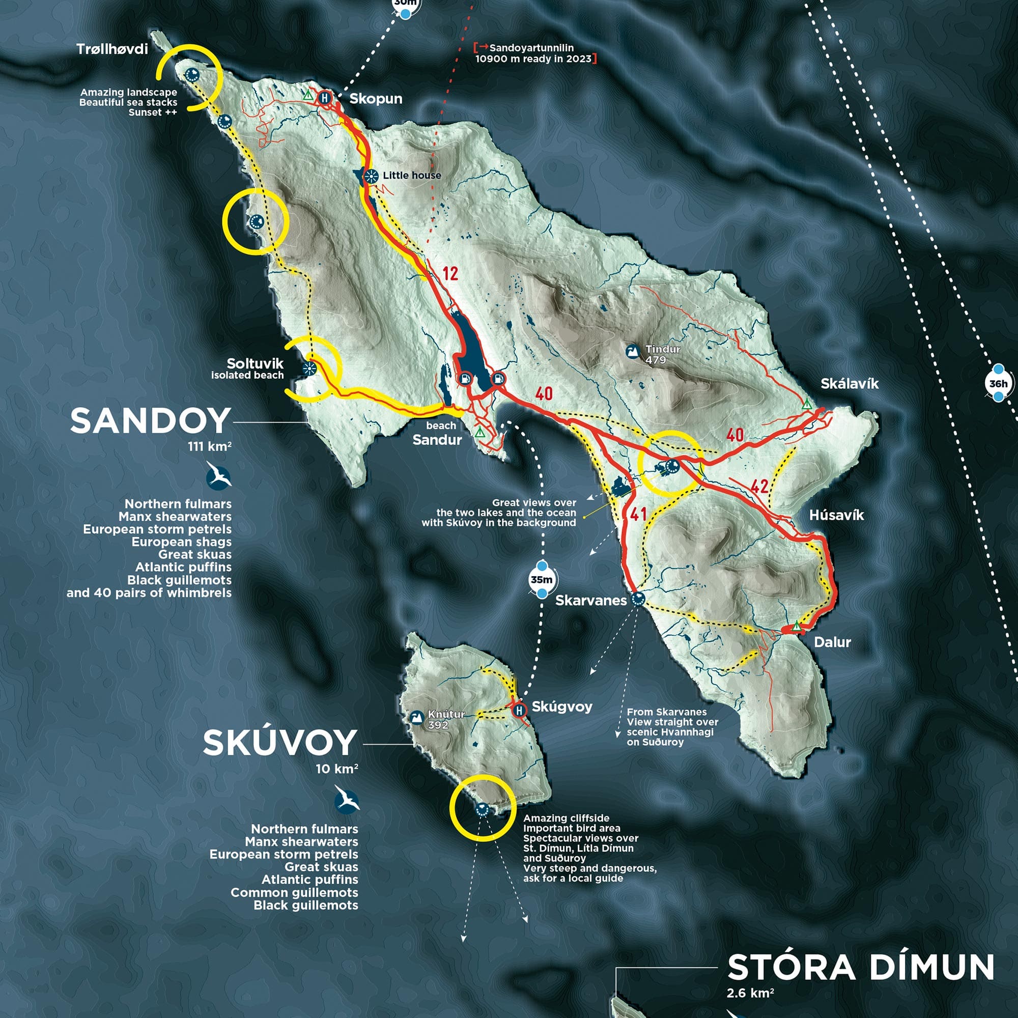
This map of the Faroe Islands is printed on a large format (100 x 70 cm), which allows you to observe all the available information at a glance. The must see**** and the yellow circles instantly guide you to the places not to be missed.
You will find the areas of photographic interest of the Faroe Islands, (waterfalls, lighthouses, monuments, fauna, flora and curiosities …) but it goes far beyond that!
Your map also offers you practical information such as road information, the “scenic roads” not to be missed, the ferry routes are also clearly detailed.
What to do in the Faroe Islands?
Like the other maps in our collection, this map brings together all the must-see places in the Faroe Islands and the information you need to make your trip unforgettable. It sums up the equivalent of a 300-page guide on a single page! Whether you are an amateur or professional photographer, a hiker who loves beautiful landscapes, it will guide you in your quest to bring back the most beautiful images and the most beautiful memories.
This 182-page guide details everything you need to know to organize your stay in the Faroe Islands. All the Islands are explained in detail, all the hikes, all the viewpoints. It is essential to read this guide if you want to optimize your trip to the Faroe Islands.
The design of the guide has been particularly carefully designed to be attractive and readable on your tablet, you can print it in High Definition if you wish.
The guide is regularly updated thanks to our contacts in the territory and the information provided by Visit Faroe Islands
Preparing your trip to the Faroe Islands
Traveling to the Faroe Islands by plane
Traveling to the Faroe Islands by ferry
The cost of living
Sleeping
Camping
Getting around the Faroe Islands
Map of bus and ferry lines in the Faroe Islands
Renting a car in the Faroe Islands
Driving in the Faroe Islands
Tunnels in the Faroe Islands
Map of Tórshavn
Taking the ferry
Taking the helicopter
Taking a taxi
Internet and telephone
Refueling / food
Refueling / electricity – laundry – alcohol
Refueling / money – photo equipment
The photographic roadtrip
Light, climate, seasons
The landscapes of the Faroe Islands
The fauna
The flora
The constructions
Surprises
Capturing Northern lights
The guide gives you a lot of information such as:
How long should you go to the Faroe Islands?
What timing should you plan for?
ISLAND BY ISLAND DETAILS /
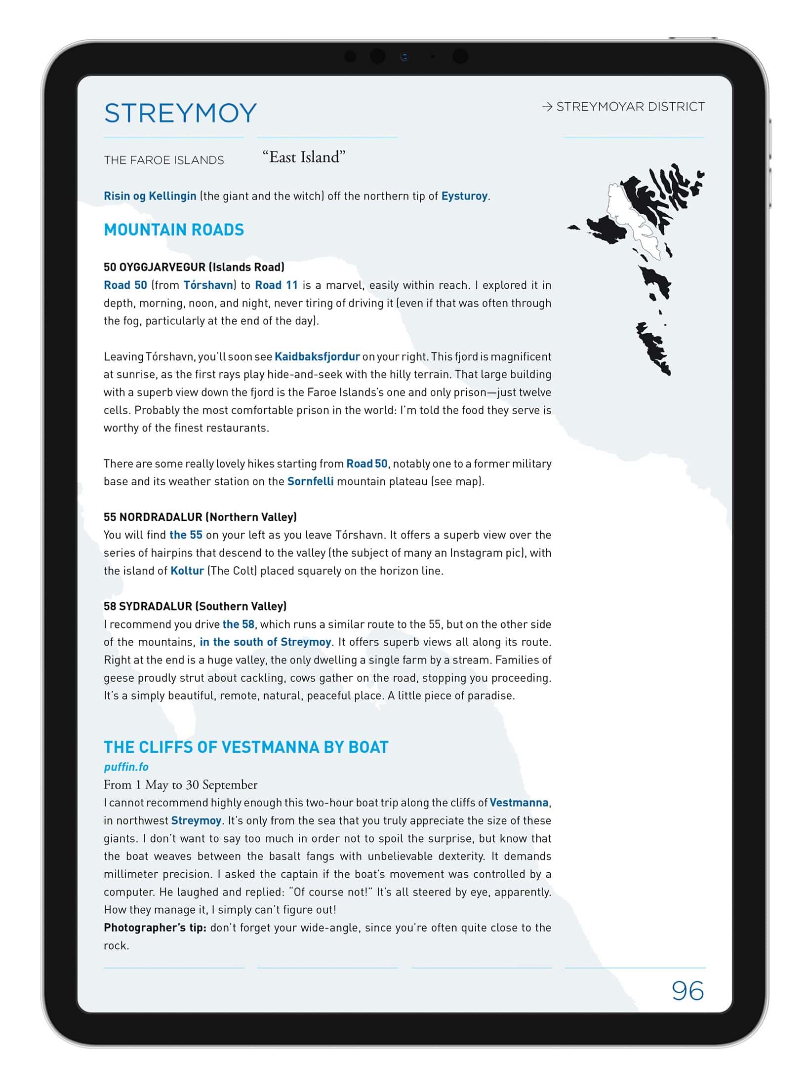
→ Visit Streymoy
→ Visit Eysturoy
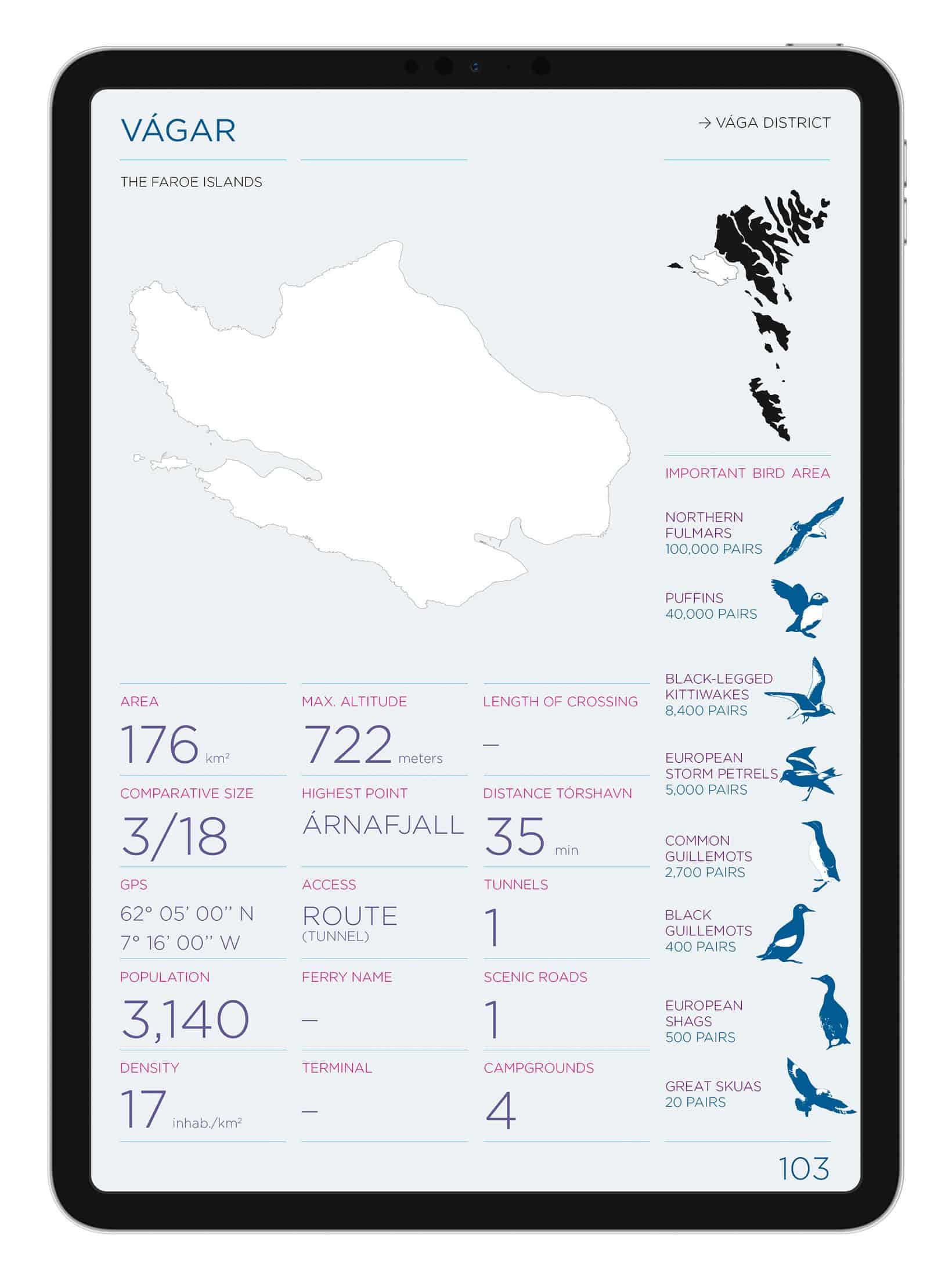
→ Visit Vagar
→ Visit Mykines
→ Visit Borðoy
→ Visit Kalsoy
→ Visit Kunoy
→ Visit Viðoy
→ Visit Svinoy & Fugloy
→ Visit Nolsoy
→ Visit Hestur & Koltur
→ Visit Sandoy
→ Visit Skuvoy
→ Visit Stora & Litla Dimun
→ Visit Suðuroy
6 easy and unmissable hikes in the Faroe Islands
Boat trips in the Faroe Islands
Suggested itineraries and lengths of stays in the Faroe Islands
Technical data of the digital guide (ebook) to the Faroe Islands:
Versions: French and English
Number of pages: 182
ISBN: 979-10-92378-03-0
BnF legal deposit: June 2018
The Digital Atlas of the Faroe Islands is a unique product. It allows you to enjoy the map immediately without worrying about the shipping time of your paper map.
It contains the printed map in High resolution spread over several pages as well as many useful maps for leaving for the Faroe Islands.
The map of the Faroe Islands in High Definition
→ All areas of interest in the Faroe Islands
→ Large amount of information thanks to several months of shipping
→ Terrain from ultra-precise satellite images
→ Complete road network
→ Main travel times by road and ferry
→ List of tunnels and their specifications
Other maps available:
→ Complete road map with service stations
→ Map of campsites in the Faroe Islands
→ Relief map including the names of all mountains
→ Faroe Islands Ferry Routes Map
→ Faroe Islands Helicopter Routes Map
→ Tórshavn Map
Technical data digital atlas of the Faroe Islands
Version: International English (basic)
Number of pages: 62
ISBN: 979-10-92378-06-1
BnF legal deposit: June 2018

Calculate your itinerary as accurately as possible to organize your trip to the Faroe Islands according to your interests: this is the objective of our maps. A few minutes are enough to organize your stay. You save time in preparation and optimize your budget.
Before departure, your map helps you plan your itinerary.
During your trip, it becomes an essential tool to not miss any of the treasures that surround you.
After your return, it will transform into a precious souvenir of your adventures, often annotated and marked with your experiences on the ground.
Are you traveling by car, van, camper, bike or motorbike? Are you planning a road trip to the Faroe Islands? This road map is for you.
The map has been specially designed for adventurers on two or four wheels. With its clear and precise road information and travel times, it allows you to view the entire territory at a glance and organize a tailor-made itinerary.
Its strength and waterproof paper will be particularly appreciated by travelers on bikes and motorbikes, who will be able to keep it constantly at hand without worrying about the rain.

We take the greatest care in developing the graphic design of our maps. It is immediately recognizable throughout our collection and whatever the territory. The yellow areas indicate the places not to be missed. The symbols, pictograms, and typography are carefully chosen, drawn, and prioritized for optimal reading and understanding even in difficult lighting conditions.
The unique and attractive design of our maps makes them a real collector’s item for many travelers. It is also available in Poster and Giant Poster format to make the trip last at home or at your workplace.
Like the Lofoten Islands maps and the Iceland map, the Faroe Islands map is printed on waterproof paper made in France, guaranteeing durability and resistance to the most extreme conditions.

The map comes with a handy leaflet to plan your trip to the Faroe Islands, allowing you to draw your routes and optimize your journey. Save valuable time and money. Get your pencils ready!
Map printed on waterproof, tear-proof paper.
Scale: 1/600,000
Open / closed format: 980 x 680 mm / 120 x 225 mm
Version: International English (basic)
Key map: English / German / French / Spanish
ISBN: 979-10-92378-08-5
BnF legal deposit: December 2018
Designed and printed in France.

Open format: 980 x 680 mm
Closed format: 120 x 225 mm

The Cards are sent in sturdy cardboard envelopes (weight 550g/m2).
Envelope size: 18 x 25 cm
Physical products are shipped every day at 4pm from Paris.
They are postmarked in PRIORITY INTERNATIONAL by La Poste.
Important Note: There is no tracking number for folded cards. Only posters and posters shipped in a tube have a tracking number.
Estimated delivery time:
France → 3 days | Europe → 4 to 10 days | World → 6 to 30 days (for distant destinations)
The speed of shipping depends on the distance and your local postal network that ensures delivery.
Important: We regret the delays but are dependent on the services of La Poste in France and your local postal service abroad. We cannot control the speed of these systems, but we always ship your cards within 24 hours of your purchase.

Your guides in ebook format can be consulted immediately after purchase on all electronic media. You will find them in your download area. They can be printed in high definition.

Traveling to the Faroe Islands means discovering a preserved archipelago, an independent territory of the Kingdom of Denmark like Greenland.
A land of contrasts, green meadows and colorful villages, the Faroe Islands offer an unforgettable experience to lovers of nature and tranquility.
In this guide, you will find all the advice to organize your stay: various maps, the entire road network with a description of all the Scenic roads, transport (bus, ferry), advice for driving, the must-sees and local tips to fully experience this corner of Nordic paradise.

Show only reviews in / Anglais (1)
You must be logged in to post a review.
INTERNATIONAL PHOTOGRAPHER is a publishing house specializing in travel and photography.
© INTERNATIONAL PHOTOGRAPHER


Yohann –
J’ai pris le pack (Carte Guide Atlas) et je ne suis vraiment pas déçu ! La carte est tout simplement magnifique. Le rendu est au delà de mes attentes. Les couleurs, les détails, la clarté, tout y est. Le guide et l’Atlas sont vraiment très bien faits également. Je les conseille. Cela sert vraiment beaucoup lors d’un voyage. Pour ma part, j’aurais aimé les avoir pour mon premier voyage aux îles Féroé. Ils me seront d’un grande utilité pour le 2nd.
Merci !!!
Stéphanie –
J’ai bien reçu les cartes et vous remercie pour la rapidité de l’envoi.
J’ai été agréablement surprise par la richesse des informations contenues dans vos eRoadbooks et votre atlas.
Je n’ai jamais vu des guides aussi complets et bien faits. Les photos sont magnifiques.
Encore merci et cordialement.
Sarah –
Ce Travel Pack Iles Féroé est un incontournable pour préparer son séjour. La carte est impressionnante de données, et le guide très complet. J’en suis ravie !
fworms –
Bravo Michael pour cet pack vraiment riche en informations et facile à utiliser sur le terrain. Il nous a été d’une aide précieuse pour préparer et réussir notre séjour. Merci !
anaislm76 –
La carte est GE-NI-ALE !! Foncez ! tout ce dont vous aurez besoin y est ou presque. Merci pour ce bijou.
Thierry Toctoucau –
C’est un superbe produit: présentation, qualité et exhaustivité des informations, conçu par un photographe professionnel donc riche d’infos pour les photographes amateurs (spots, lumière…) ! La carte est un must, on aimerait que beaucoup d’autres destinations soient traitées de la même façon, tiens les îles Lofoten par exemple!
Frederick Gaillard –
Très bon pack complet que j’ai acheté pour préparer mon périple dans les Féroé, l’ebook est génial, belles photos, nombreuses informations et détails actualisés. Un des plus gros contenu français que j’ai pu trouver sur cette île. La carte me sera extrêmement utile pour mon voyage, il me tarde de partir à l’aventure.
Si la carte des Lofoten est autant exhaustive, je l’attend avec impatience!!
fersen sherkann –
C’est amusant, je t’ai découvert Michaël Lévy grâce à ta carte et ton guide sur l’ISLANDE en 2013 ; nous nous sommes rencontrés à Paris, une belle rencontre, j’ai vu ta passion pour la Bretagne et Ouessant (mon Pays) ; récemment, en avril 2023, tu m’as orienté sur les falaises des îles Féroés grâce à ton nouveau guide (superbe à tous niveaux et m’ayant permis de sortir des senties battus) … et voilà que tu réalises une nouvelle création sur les îles Lofoten ?! … Je connais Senja et envisage de découvrir les Lofoten l’hiver prochain 🙂 Tu es super, tu anticipes mes voyages 🙂 Merci et bravo pour ton talentueux travail.
Eliane –
Consulter le guide et l’atlas, c’est déjà partir en voyage… Belle qualité graphique… n’aimant pas lire sur écran, j’ai hésité à commander ce guide numérique, mais la présentation est si soignée et si aérée que la lecture en est très confortable, même sur smartphone. Le guide est riche en renseignements et en anecdotes utiles pour mieux comprendre les îles et leurs habitants. Même après le voyage, j’ai plaisir à m’y replonger ! La carte est d’une telle qualité qu’à mon retour je l’ai affichée dans mon salon. N’hésitez pas… C’est un très bel objet !
Jan Torremans –
while preparing an Iceland trip in 2016, bumped into Michael’s website and bought his map & roadbook. It was a great ‘icing’ on the cake and real added value to our trip: perfect ‘material’ for the harsh weather conditions in Iceland, great photo locations off the beaten track. Great storybook. That made me decide to buy the same pack for our trip to de Faroer Islands in june 2025. Easy ordering, fast delivery. Using Michael’s experiences in th Nordics, adds a great value to your trips. Thnx Michael, for the great work. Keep going.
Pauline COGNIN –
Pendant les préparatifs du voyage, la carte des Îles Féroé couplée au e-Roadbook ont été mes meilleurs amis.
Mine de rien, nous partions en camping avec des enfants de 3 et 5 ans alors pas de place au hasard pour prévoir des itinéraires et des randonnées adaptées.
Puis pendant le voyage, elle était toujours là. À peine en voiture, elle était ouverte sur mes genoux pour faire le co-pilote.
Au total elle aura survécu à 7 îles différentes en 15 jours, un nombre incalculable de tempêtes, et surtout aux petites mains curieuses mais pas toujours délicates de nos enfants. C’est pour dire la solidité du papier utilisé.
Pour finir, un grand merci Mickaël car ce sont tes publications qui nous ont donné envie de découvrir ces îles magnifiques. Nous en garderons un souvenir mémorable (mais humide 😅)