Cart (0)
Close


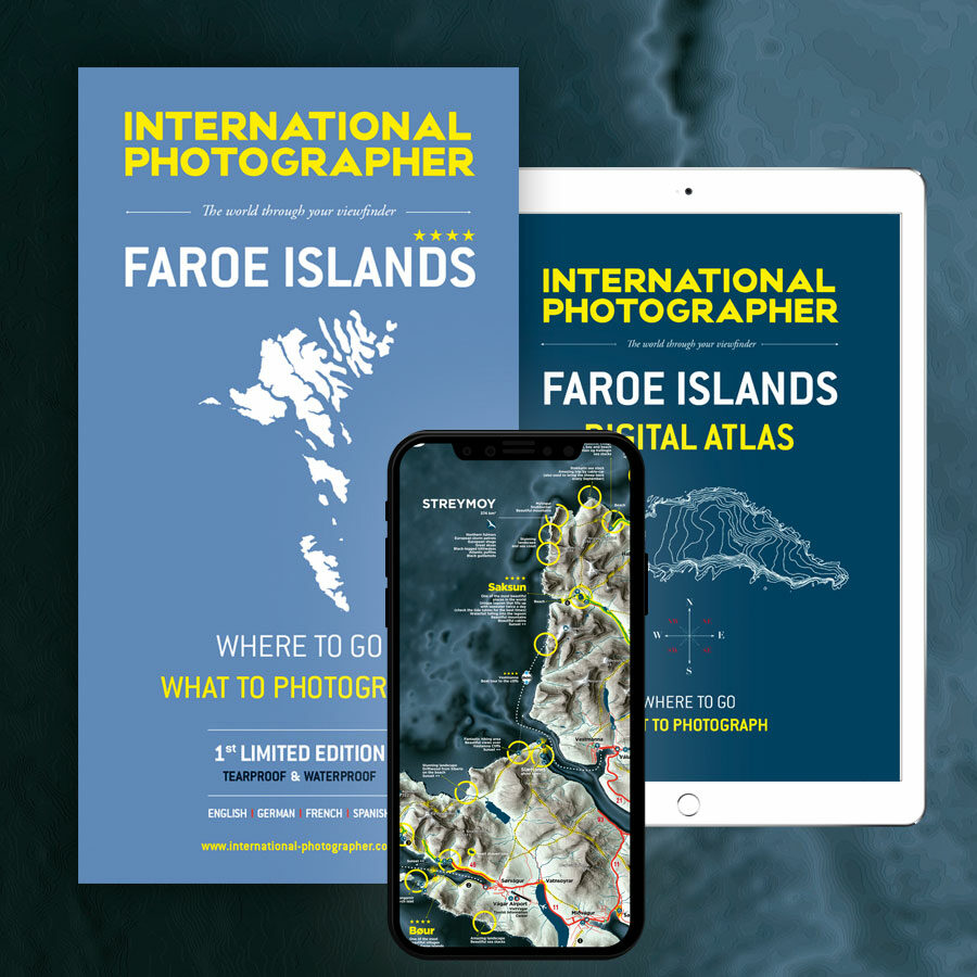
This luxury pack includes 4 essential products:
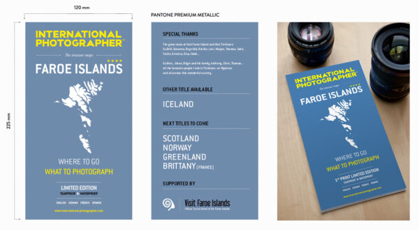
1 – Waterproof printed map of the Faroe Islands 1/125.000
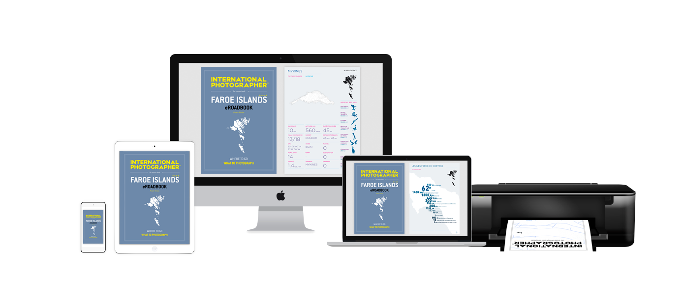
2 – Guide of the Faroe Islands (ebook, 182 pages).
3 – Digital Atlas including the map in HD spread over 16 pages + more useful maps (ebook, 63 pages).
→ Instant download of the 3 ebooks after purchase.
The Map, Guide and Digital Atlas of the Faroe Islands are included in this Travel Pack.
The Faroe Islands are a true paradise. This discreet archipelago, lost between Scotland and Iceland, occupies, since my first trip in January 2017, the center of all my attentions.
The Digital guide + Atlas + printed map brings all that you need for a perfect trip to the Faroe Islands.
Three indispensable tools to not miss anything of this flamboyant territory.
This project has been supported by Visit Faroe Islands.
![]()
SHIPPING
→ The map is shipped in PRIORITY INTERNATIONAL MAILING.
→ Instant download of the 3 ebooks after purchase.
Loading...
Description
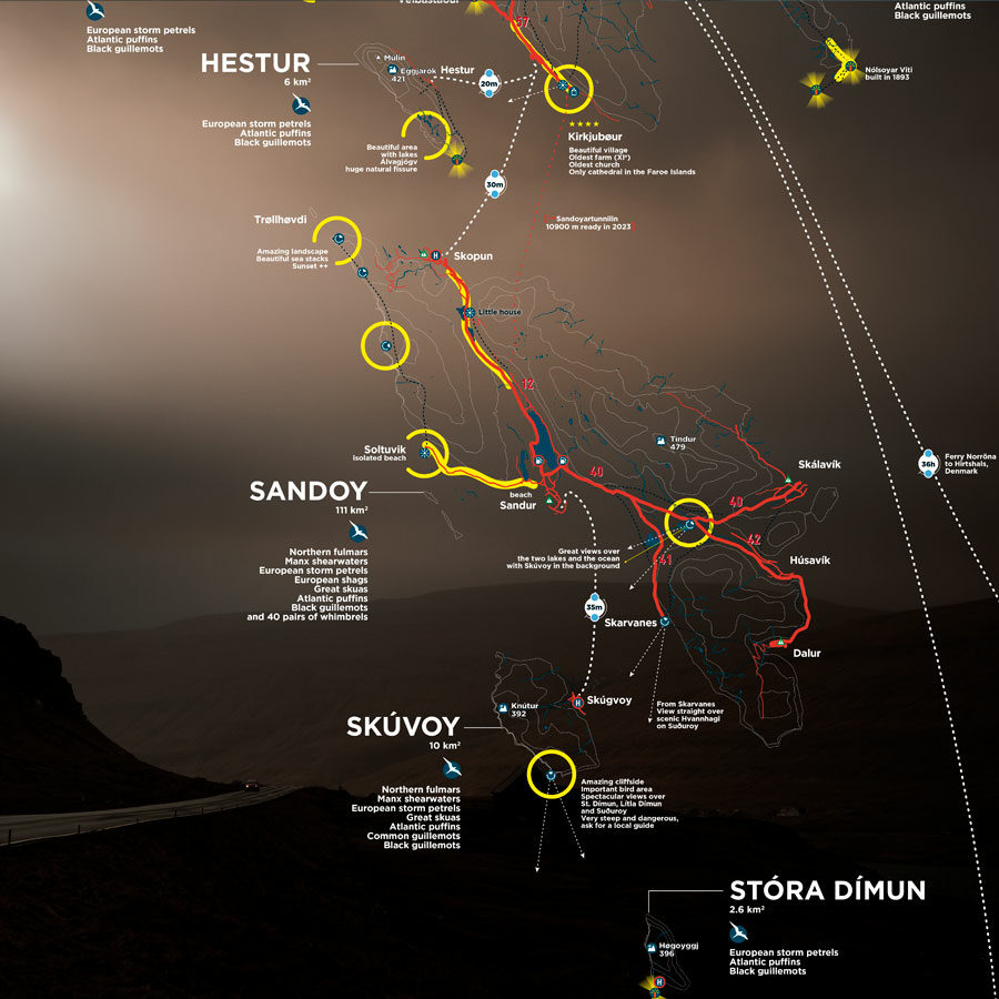
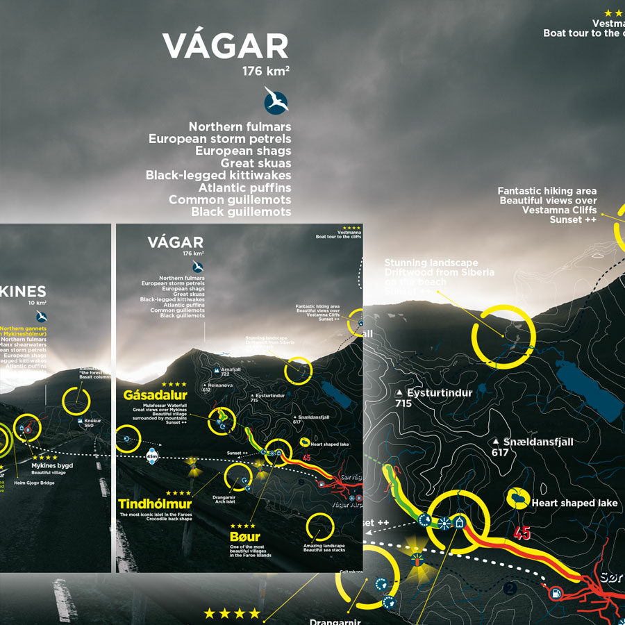
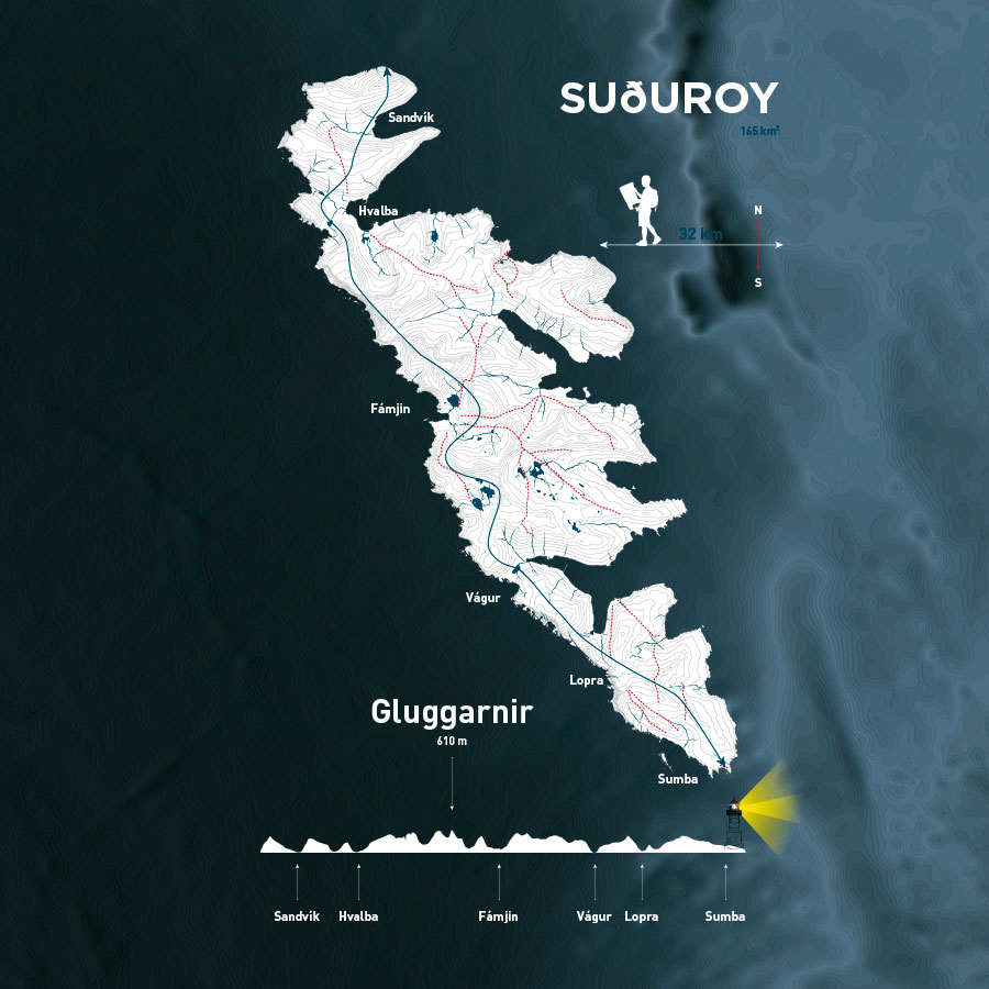
1 – MAP OF THE FAROE ISLANDS
CONTENT
From satellite imagery in very high definition and using the latest technology, the map of the Faroe Islands offers you what is best in terms of information, design, and enjoyment of use.
You will find essential road information as well as a detailed description of all areas of interest (mountains, cliffs, waterfalls, lighthouses, remarkable churches, fauna, flora and curiosities …).
ADVANTAGES OF THE MAP
→ Many informations thanks to several months of exploration.
→ Terrain from ultra-precise satellite images (5 meters).
→ Complete road network.
→ Main travel times by car and ferry.
→ List of tunnels and their specifications.
→ Increased contrast and readability thanks to the best inks including a metallic ink.
→ Map key in 4 languages: English / German / Spanish / French.
→ Tearproof and waterproof paper.
TECHNICAL DATA
Scale: 1/125.000
Open / Closed format : 980 x 680 mm / 120 x 225 mm
Version: International English (basic)
Map Key: English / German / French / Spanish
ISBN: 979-10-92378-02-3
BnF legal deposit: May 2018
Designed in France. Printed in France.

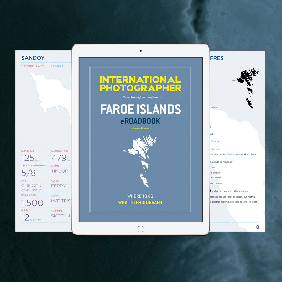
2 – ATLAS OF THE FAROE ISLANDS
CONTENT
The Digital Atlas is a new product that allows you to immediately enjoy the map without worrying about the shipping time of your printed map. It’s also a good back-up in case that you loose it!
This atlas contains the printed map spread over several pages as well as many useful maps for your trip.
ADVANTAGES
→ Many informations thanks to several months of exploration.
→ Terrain from ultra-precise satellite images (5 meters).
→ Complete road network.
→ Main travel times by car and ferry.
→ List of tunnels and their specifications.
→ Increased contrast and readability thanks to the best inks including a metallic ink.
TECHNICAL DATA
Légal Deposit French National Library : June 2018.
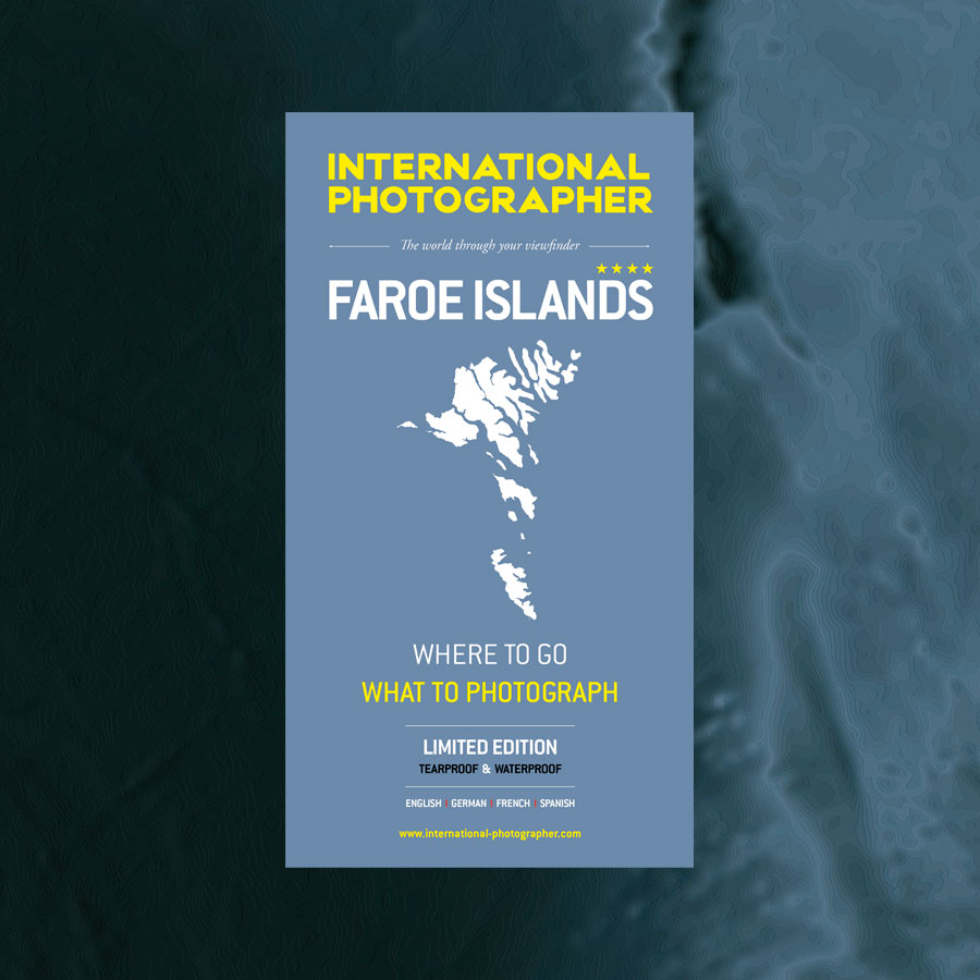
3 – eROADBOOK OF THE FAROE ISLANDS
PLANNING YOUR TRIP
Foreword
Summary
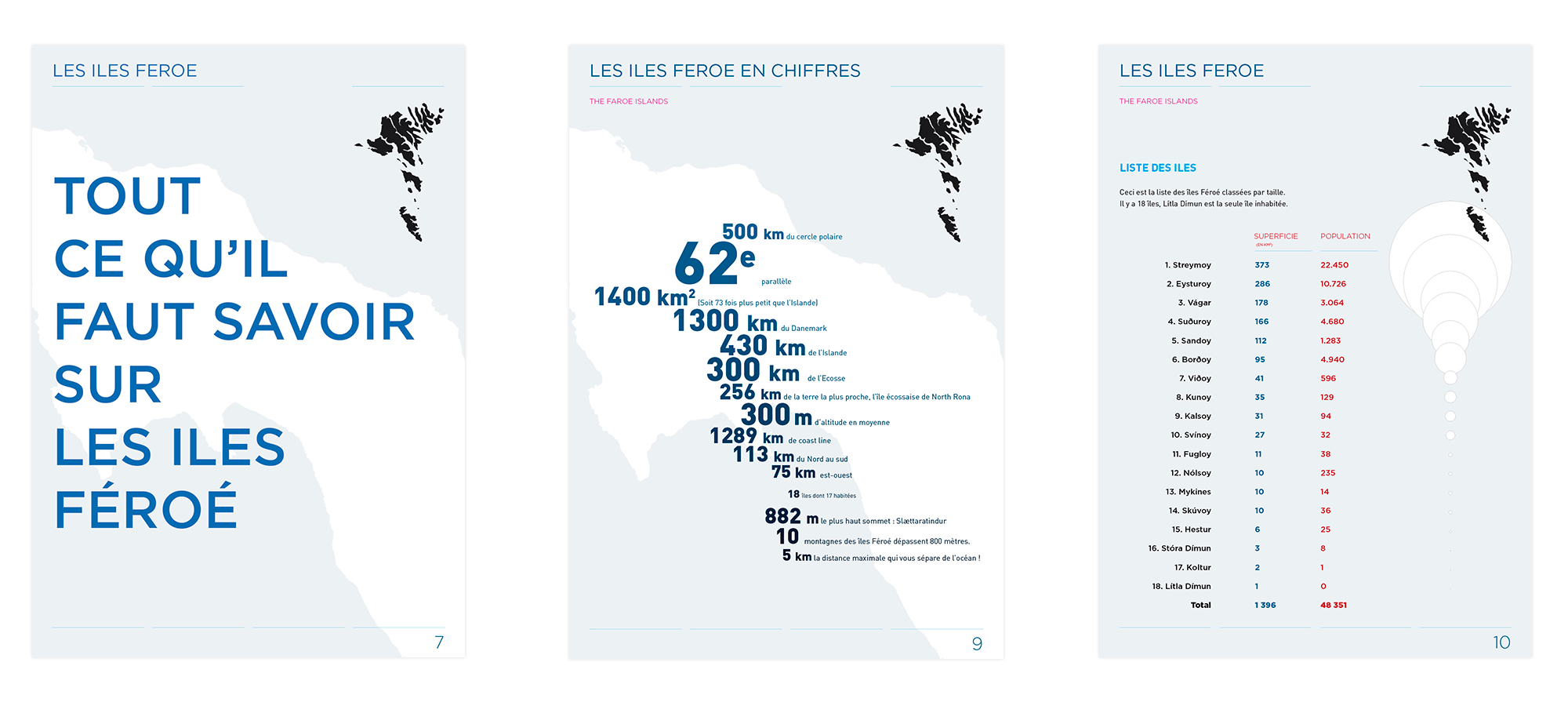
All you need to know about the Faroe Islands
History of the faroe Islands
The Merkid
The faroese
Plan your trip
Going to the Faroes by plane
Going to the Faroes by ferry
Money matters
Sleeping
Camping
Moving around
Map of the ferry and buses routes
Renting a car
Drive in the Faroes
The tunnels
Map of Tórshavn
Take the ferry
Take the helicopter
Take the taxi
Internet and telephone
Food supply
Electricity – laundry – alcool supply
Money – photo gear supply
The photographic roadtrip
Light, climate, seasons
Landscapes
Fauna
Flora
Monuments
Surprises
Aurora borealis
THE ROADTRIP
Leaving how long?
Timing?
Details by island
→ Streymoy
→ Eysturoy
→ Vagar
→ Mykines
→ Borðoy
→ Kalsoy
→ Kunoy
→ Viðoy
→ Svinoy & fugloy
→ Nolsoy
→ Hestur & koltur
→ Sandoy
→ Skuvoy
→ Stora & litla dimun
→ Suðuroy
6 easy hikes you should do
Boat trips
Tours exemples
APPENDICES
Photographic gear
backups
Statistics
Analyse
Drone regulations
Glossary
Profile of the islands
Useful contacts
Rules for using the eROADBOOK
Many PHOTOS with EXIFS, fully illustrated.
FAROE ISLANDS eROADBOOK V1 | 182 pages
Reviews (9)
9 reviews for FAROE TRAVEL PACK 2024 (Map+Guide+Atlas)
Show only reviews in / Anglais (0)
You must be logged in to post a review.
Bundled products
Related products
-

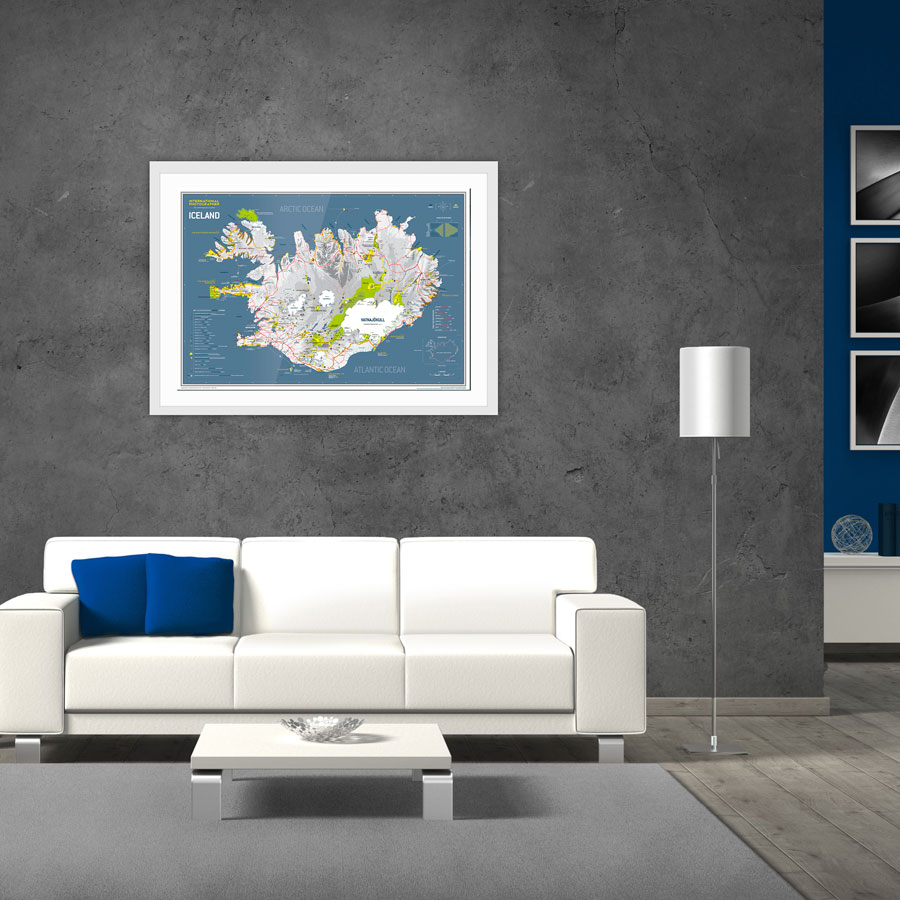
ICELAND FINE ART MAP
29.00€ -
ICELAND GIANT POSTER
34.00€
Yohann –
J’ai pris le pack (Carte Guide Atlas) et je ne suis vraiment pas déçu ! La carte est tout simplement magnifique. Le rendu est au delà de mes attentes. Les couleurs, les détails, la clarté, tout y est. Le guide et l’Atlas sont vraiment très bien faits également. Je les conseille. Cela sert vraiment beaucoup lors d’un voyage. Pour ma part, j’aurais aimé les avoir pour mon premier voyage aux îles Féroé. Ils me seront d’un grande utilité pour le 2nd.
Merci !!!
Stéphanie –
J’ai bien reçu les cartes et vous remercie pour la rapidité de l’envoi.
J’ai été agréablement surprise par la richesse des informations contenues dans vos eRoadbooks et votre atlas.
Je n’ai jamais vu des guides aussi complets et bien faits. Les photos sont magnifiques.
Encore merci et cordialement.
Sarah –
Ce Travel Pack Iles Féroé est un incontournable pour préparer son séjour. La carte est impressionnante de données, et le guide très complet. J’en suis ravie !
fworms –
Bravo Michael pour cet pack vraiment riche en informations et facile à utiliser sur le terrain. Il nous a été d’une aide précieuse pour préparer et réussir notre séjour. Merci !
anaislm76 –
La carte est GE-NI-ALE !! Foncez ! tout ce dont vous aurez besoin y est ou presque. Merci pour ce bijou.
Thierry Toctoucau –
C’est un superbe produit: présentation, qualité et exhaustivité des informations, conçu par un photographe professionnel donc riche d’infos pour les photographes amateurs (spots, lumière…) ! La carte est un must, on aimerait que beaucoup d’autres destinations soient traitées de la même façon, tiens les îles Lofoten par exemple!
Frederick Gaillard –
Très bon pack complet que j’ai acheté pour préparer mon périple dans les Féroé, l’ebook est génial, belles photos, nombreuses informations et détails actualisés. Un des plus gros contenu français que j’ai pu trouver sur cette île. La carte me sera extrêmement utile pour mon voyage, il me tarde de partir à l’aventure.
Si la carte des Lofoten est autant exhaustive, je l’attend avec impatience!!
fersen sherkann –
C’est amusant, je t’ai découvert Michaël Lévy grâce à ta carte et ton guide sur l’ISLANDE en 2013 ; nous nous sommes rencontrés à Paris, une belle rencontre, j’ai vu ta passion pour la Bretagne et Ouessant (mon Pays) ; récemment, en avril 2023, tu m’as orienté sur les falaises des îles Féroés grâce à ton nouveau guide (superbe à tous niveaux et m’ayant permis de sortir des senties battus) … et voilà que tu réalises une nouvelle création sur les îles Lofoten ?! … Je connais Senja et envisage de découvrir les Lofoten l’hiver prochain 🙂 Tu es super, tu anticipes mes voyages 🙂 Merci et bravo pour ton talentueux travail.
Eliane –
Consulter le guide et l’atlas, c’est déjà partir en voyage… Belle qualité graphique… n’aimant pas lire sur écran, j’ai hésité à commander ce guide numérique, mais la présentation est si soignée et si aérée que la lecture en est très confortable, même sur smartphone. Le guide est riche en renseignements et en anecdotes utiles pour mieux comprendre les îles et leurs habitants. Même après le voyage, j’ai plaisir à m’y replonger ! La carte est d’une telle qualité qu’à mon retour je l’ai affichée dans mon salon. N’hésitez pas… C’est un très bel objet !