
ICELAND GIANT POSTER
39.99€


29.99€ Original price was: 29.99€.24.99€Current price is: 24.99€.
→ NEW LIMITED EDITION. 2000 copies.
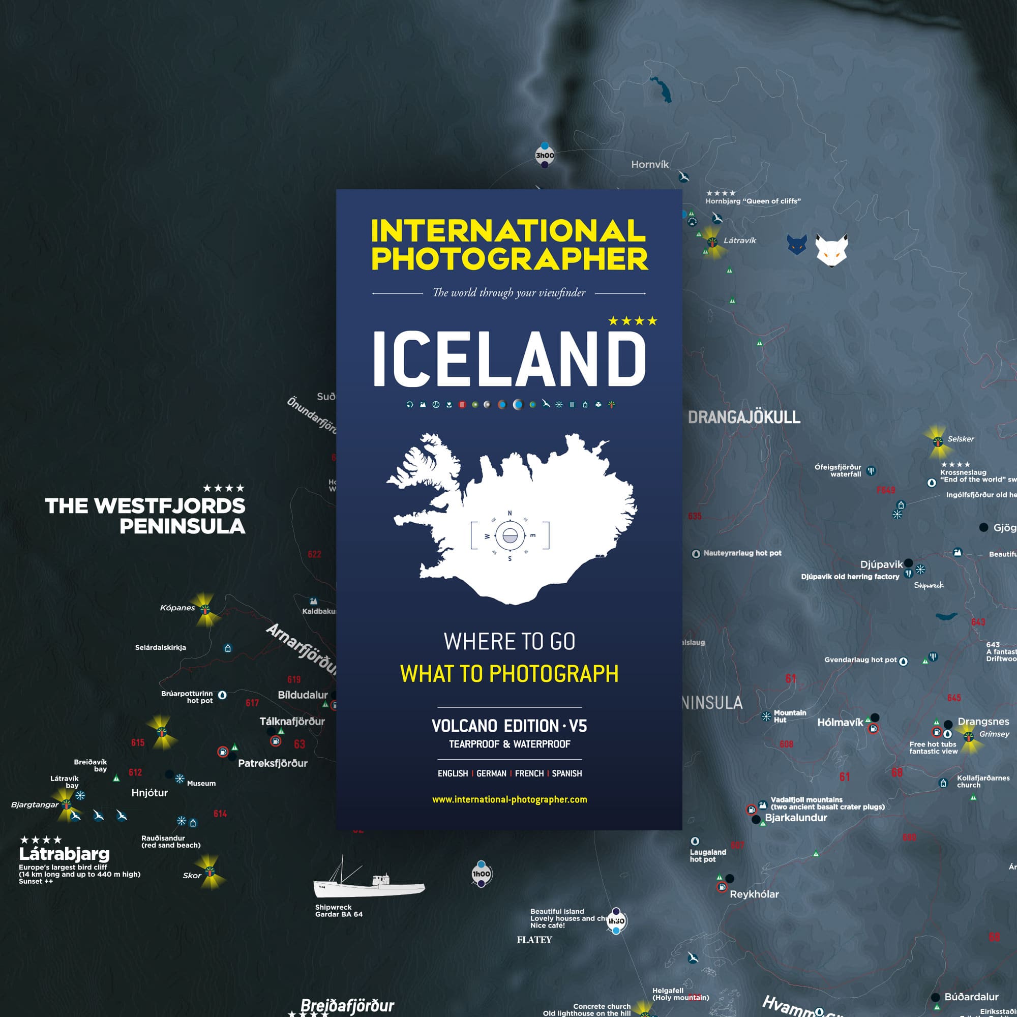
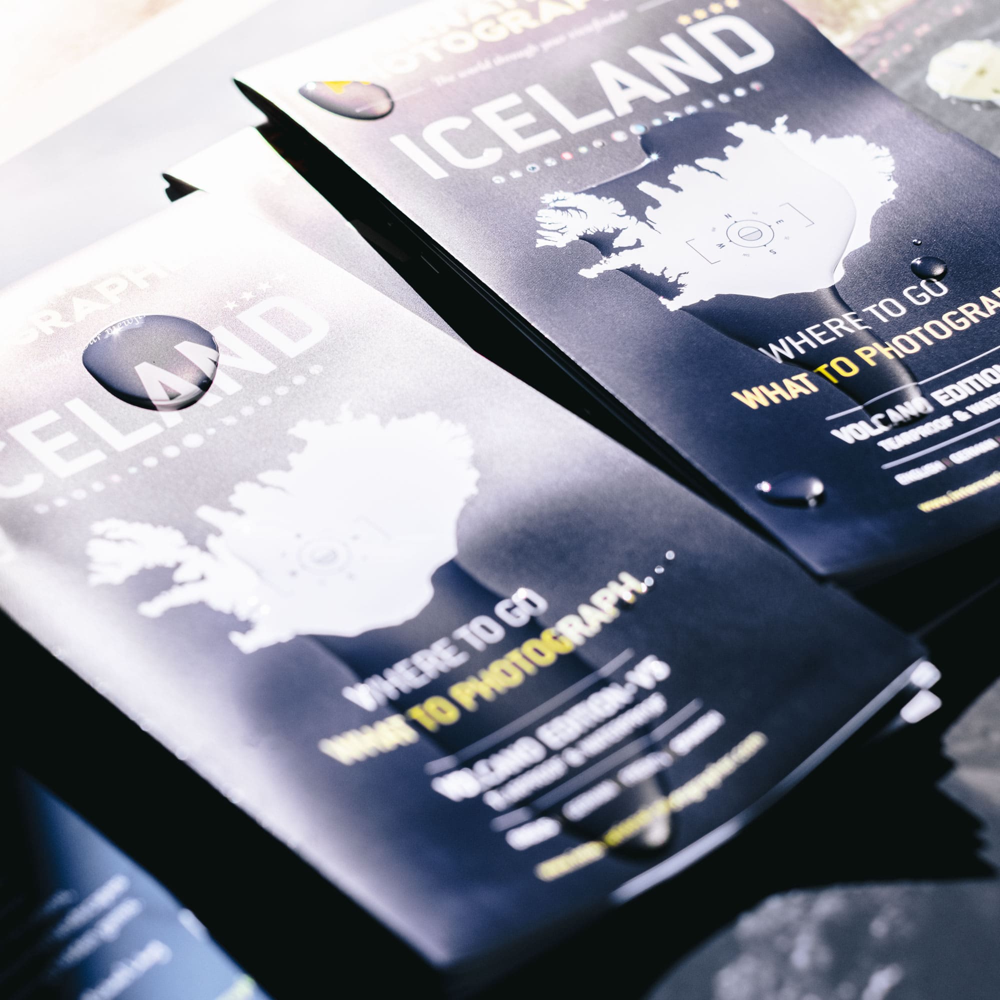
The Iceland Photographer’s Map is our best-seller with over 20,000 copies sold since 2012.
This new version V5 brings updates on the V4 SILVER EDITION (sold-out). Known to all Iceland lovers, sold in more than 100 countries, it is the essential tool to prepare your trip and not miss any photographic spot.
Made and printed in France, this map of Iceland is the photographer’s best ally on the Icelandic trails.
This map is accompanied by an A4 leaflet that allows you to plan your road trip in Iceland.

→ Shipping in a cardboard envelope from Paris within 24 hours of your purchase.
Iceland is the favorite destination of INTERNATIONAL PHOTOGRAPHER. It’s the country that inspired us to create maps for photographers who are passionate about Iceland. Our maps have been guiding you across this vast land since 2012 !
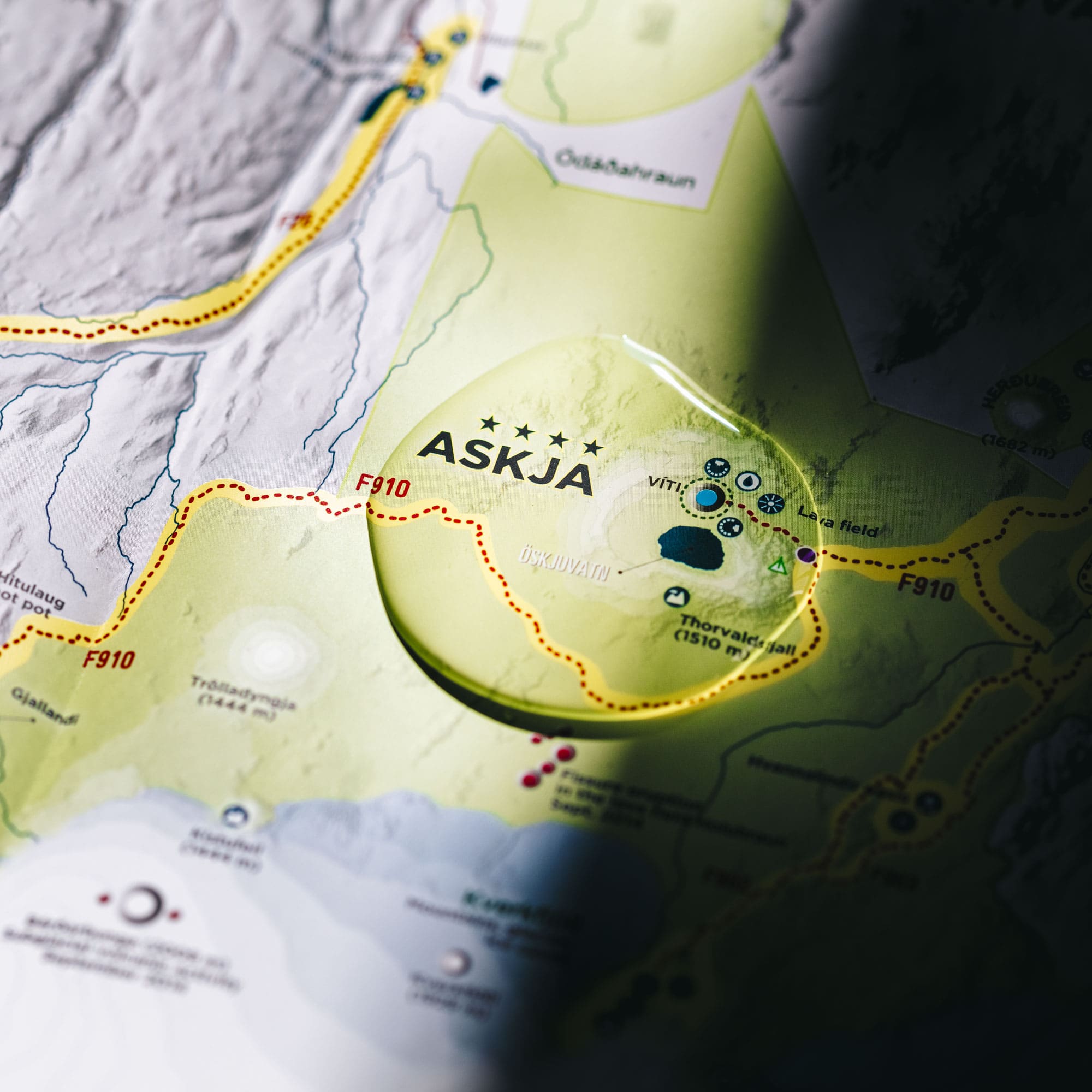
This 5th edition map of Iceland is printed in a large format (100 x 70 cm). This road map of Iceland allows you to see all the available information at a glance. The must-see spots and yellow-highlighted areas instantly guide you to the places you shouldn’t miss.
You will find areas of photographic interest (volcanoes, waterfalls, lighthouses, monuments, wildlife, flora, and curiosities…) as well as national parks and nature reserves. But it goes much further !
Your map of Iceland also provides practical information such as road details, travel times on trails, gas stations… Ferry routes are also clearly outlined. All the information you need is gathered right before your eyes.
Calculate your itinerary accurately to plan your trip to Iceland based on your interests: that’s the goal of our maps. A few minutes are enough to prepare your stay. You save preparation time and optimize your budget while you’re there.
Before departure, your map helps you plan your itinerary. During your trip, it becomes an essential tool to ensure you don’t miss any of the treasures around you. After your return, it transforms into a valuable souvenir of your adventures, often annotated and marked with your precious experiences on the ground.

What to do in Iceland?
Like the other maps in our collection, this map brings together all the must-see spots in Iceland and the information needed for an unforgettable trip. It offers the equivalent of a 300-page guide on a single page! Whether you are an amateur or professional photographer, a hiker, or simply a lover of beautiful landscapes, it will guide you in your quest to bring back the most stunning images and the best memories.
We take great care in the development of the graphic design of our maps. It is recognizable throughout our collection and across all territories. The yellow areas catch your eye: they instantly indicate the must-see places. The symbols, icons, and typography are carefully chosen, designed, and organized for optimal reading and understanding, even in challenging lighting conditions.
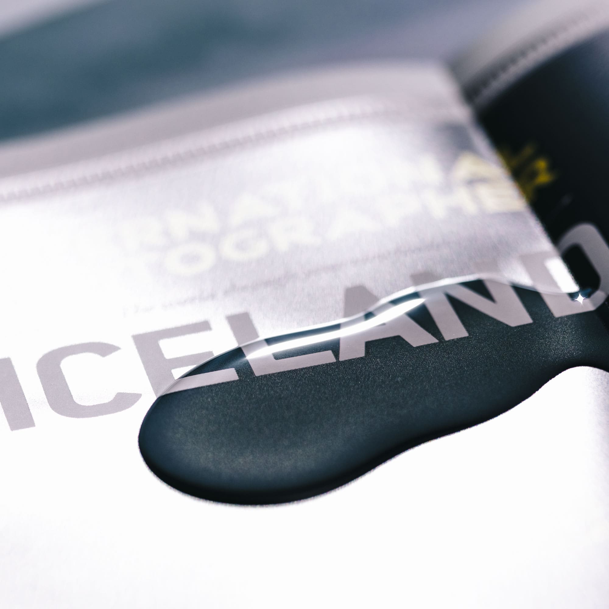
Like the maps of the Lofoten Islands and the Faroe Islands map, the Iceland V5 map is printed on unique paper that is waterproof, sturdy, and very soft to the touch. It is made in France and ensures durability and resistance to the most extreme conditions.
The map comes with a practical A4 brochure to help plan your trip to Iceland; it allows you to sketch your itineraries and optimize your route. Save valuable time and save on your budget. Grab your pencils!


Scale: 1/600,000
Open/closed format: 980 x 680 mm / 120 x 225 mm
Version: International English (basic)
Legend: English / German / French / Spanish
ISBN: 979-10-92378-08-5
Legal deposit BnF: December 2022
Designed and printed in France

Open format: 980 x 680 mm
Closed format: 120 x 225 mm

The maps are shipped in sturdy cardboard envelopes (weight 550g/m²).
Envelope dimensions: 18 x 25 cm
Physical products are shipped daily at 4 PM from Paris.
They are sent via PRIORITY INTERNATIONAL by La Poste.

Show reviews in all languages (15)
You must be logged in to post a review.
INTERNATIONAL PHOTOGRAPHER is a publishing house specializing in travel and photography.
© INTERNATIONAL PHOTOGRAPHER


Mark Zaslona –
Once again my apologies for using Google Translate to write to you in French and I hope the grammar makes you laugh.
The map arrived last Saturday afternoon, safe and sound. THANK YOU, THANK YOU, you have made an old man very happy.
Once again words fail me, how to express my admiration for such a superb and truly useful map. Even if you are not a photographer, this map will help you find your way to some of the most beautiful places in Iceland.
A fantastic achievement, especially with all the problems you had during the Covid pandemic and completing version 4.
I visited Iceland for the seventh time in September 2022 and will be returning later this year for a long stay.
I understand that you are currently preparing another similar map for the Lofoten Islands in Norway. Can you please add my name to your mailing list, when this is ready to buy.
Again a huge thank you to all involved in preparing this essential guide.
Encore une fois mes excuses pour avoir utilisé Google Traduction pour vous écrire en français et j’espère que la grammaire vous fera rire.
La carte est arrivée samedi après-midi dernier, saine et sauve. MERCI, MERCI, vous avez rendu un vieil homme très heureux.
Encore une fois les mots me manquent, comment exprimer mon admiration pour une carte aussi superbe et vraiment utile. Même si vous n’êtes pas photographe, cette carte vous aidera à trouver votre chemin vers certains des plus beaux endroits d’Islande.
Une réalisation fantastique, surtout avec tous les problèmes que vous avez eus pendant la pandémie de Covid et l’achèvement de la version 4.
J’ai visité l’Islande pour la septième fois en septembre 2022 et j’y retournerai plus tard cette année pour un long séjour.
Je comprends que vous préparez actuellement une autre carte similaire pour les îles Lofoten en Norvège. Pouvez-vous s’il vous plaît ajouter mon nom à votre liste de diffusion, lorsque cela est prêt à acheter.
Encore un grand merci à tous ceux qui ont participé à la préparation de ce guide essentiel.
mike cantwell –
It’s a first class presentation and map. Michael went out of his way and expense to ship a second map to me when the first one didn’t arrive. He made sure I was happy and I am. I love the map. It’s very detailed and made with quality materials. Thanks again. I highly recommend this product.
Phillip Senior –
Hello Michael,
I have received the maps you sent and I could not be happier! They exceeded my expectations in every way, they are beautiful and extremely well made. We are planning our trip for May this year and I am already thinking about going back to see what we miss this time.
Thank-you, Thank-you, Thank-you.
With our best wishes from Toronto Canada,
Phill Senior
Pete Zister –
First, the map is outstanding Michael. Thank you for the time you have taken to highlight the most scenic locations in Iceland. If anyone is going to Iceland, this map is a “must get”!!! Being this is a “photographer” map, can someone shed some light on how to read the positioning of the “Photographic and panoramic spot” symbols. It looks like the symbols are facing different directions. Was that intentional and does that mean something? i.e. the direction you should “shoot” from? or is that the direction you shoot for a sunrise or sunset pic? Continuing with that last question, it would be nice if there would be a chat room about the Waterfalls (or any photographic spot for that matter) where people could share whether you should be at the spot for sunrise or sunset in order to get the best light. Maybe there is already and I am just not aware of it. Thanks for anyone who can shed some light on the questions about the “photographic symbol” and thanks again Michael!
Pete
Alessandro Guarnieri –
I ordered the Iceland Map V5, and it’s really well made. The material is excellent, but the real gem is the content. It’s rich in details and information, covering roads, fuel stations, photo spots, and average travel times for various scenic/photographic routes. There are charts showing the daylight/darkness hours for each month of the year. Many other details are included, making the map useful for any type of tourist. It’s also very beautiful to display in a frame at home. Highly recommended!
Gaël Touleron –
Carte super pratique lors de notre tour de l’Islande !
Nous avons tellement été convaincus que nous avons acheté sans hésiter celle pour les îles Lofoten, notre prochain voyage 🤗 !